The villages were during the 15th century anonymous and the individual homesteads were not officially named until the 16th century. We know a few things about the ownership of Överstad, since the village, or at least some of the homesteads, were included in the Saviour’s Manor of Svenneby. The village was acquired during the dramatical years after the Black Death by a lower aristocracy man, Lafrin Fröstensson. After a short time period it became a property of the abbey. The village was then included in Askeby abbey estates, as did about 70 percent of the homesteads within the parish.

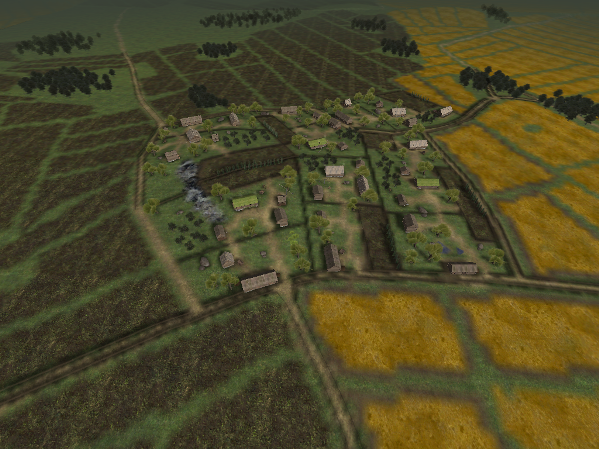
Överstad was a clustered village by a road that is still used today.
By doing field hikes, we tried to identify the site boundaries and also get a picture of the agricultural landscape during the 15th century. Traces of medieval settlement are missing, but houses are marked out on cartographic documents from the 17th century. In the visualization we have used buildings of a type considered to be common in middle of Sweden during the 15th century. However, we faced a huge problem. During the 15th century, the village probably consisted of only four homesteads, while the cartographies from the 17th century show six homesteads. This is why we preferred to show the 17th century village.
